
Designed for the future
Ideal navigation instrument for TMG/UL and LSA aircrafts. Featuring extremely bright colour display from 2.8-7.0 inch size, free airspaces and airport databeses, integrated Flarm and comes with the whole world terrain preloaded.
2.8 – 7.0”
High Brightness.
1
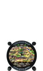
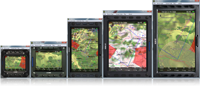
Different sizes to fit any need.
PowerFlarm Integrated.
Portrait or Landscape.
Simple conversion from a Portrait to Landscape at any time.
*Portrait mode not available on 803 and 804 devices
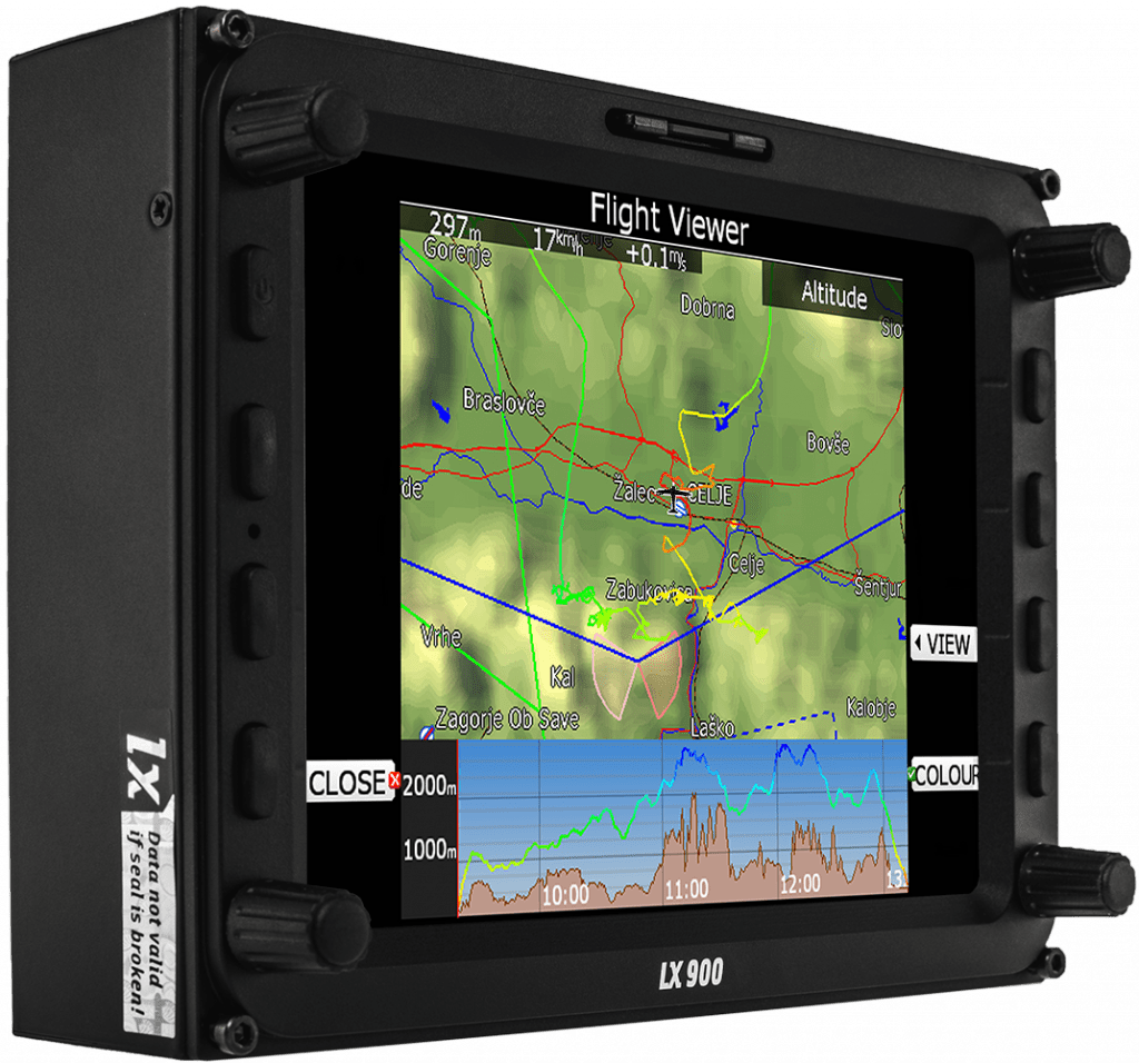
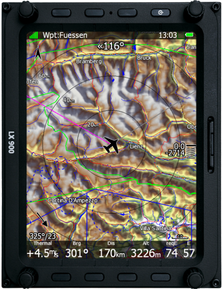
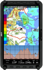
The MAP. Details. Whole world.
Preloaded worldwide terrain, map, airspace and airpot databases – FREE of charge!
ICAO. Ifos. Rogersdata.
Buy and load your own ICAO maps.
LX philosophy.
We kept the same logic, which is already well proven on our top of the market gliding instruments
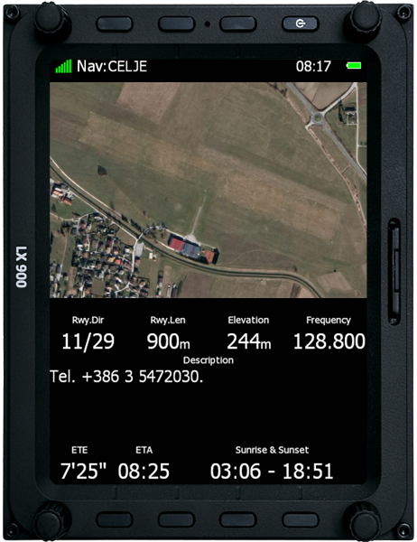
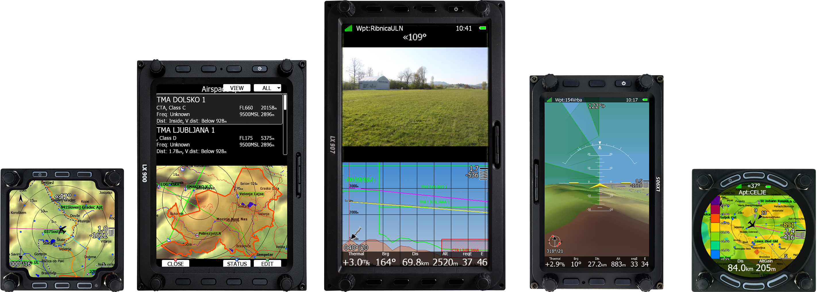
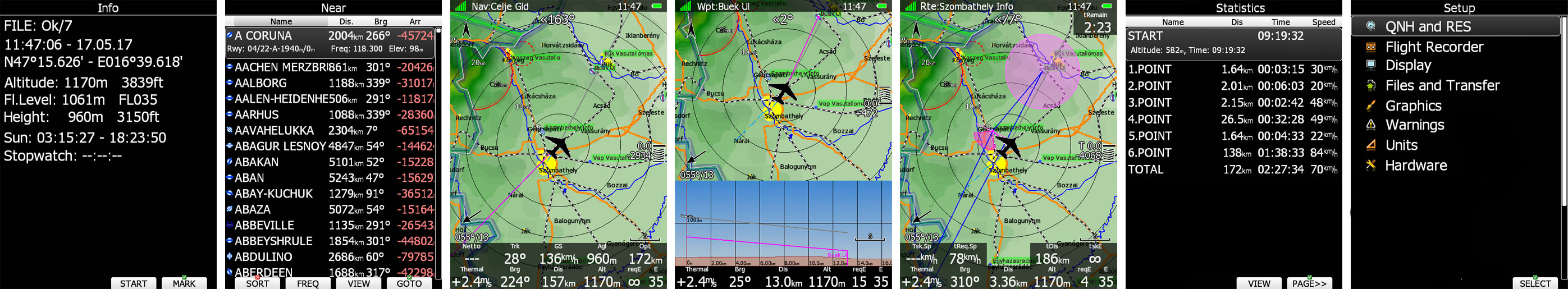
NAV mode. RWY info.
Navigation mode navigates to a selected airport with all needed information, such as RWY direction, length, frequency and status (grass/asphalt). Every page layout can be completely customised by LX Styler.
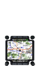
WAYPOINT and ROUTE mode
A very simple selection of a Waypoint with an intuitive user interface. Create a Route on the device or simply load a premade one it via the SD card or WI-FI.
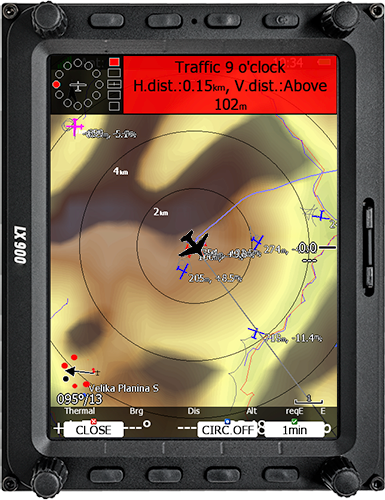
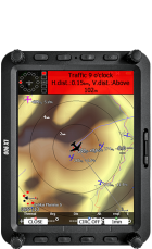
FLARM mode
It shows all different types of FLARM objects, ADS-B objects and PCAS if external devices are connected.
FLARM visual radar with warnings.
Radar shows all necessary data. Present position and altitude is seen on the map. Automatically POP-UPs a new alert when a potential collision can happen.
Internal/External. TRX1090 supported.
Flarm/PowerFlarm can be either an internal or an external module. Internal Flarm can be extended with a TRX1090 which is a ADSB capable
Wi-Fi connectivity. SD card. GPS module. USB.
Wi-Fi module, SD card socket, 56 channels GPS module built in and USB port for data exchange and smartphone charge.
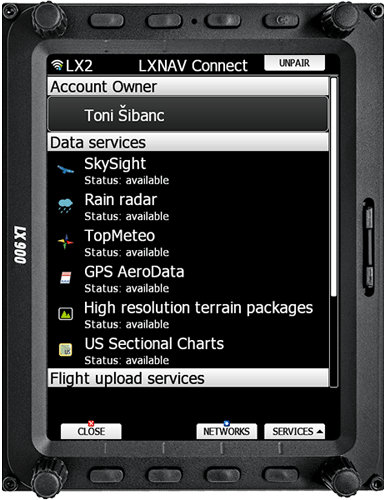
Be online anytime, anywhere.
With LXNAV Connect and Wi-fi module, unlock the full potential of your device.
Many differend services with even more on the way.
NOTAMs, flight uploads, GPSAeroData, US Charts, device upgrades and many other features are now just a click away even while flying.
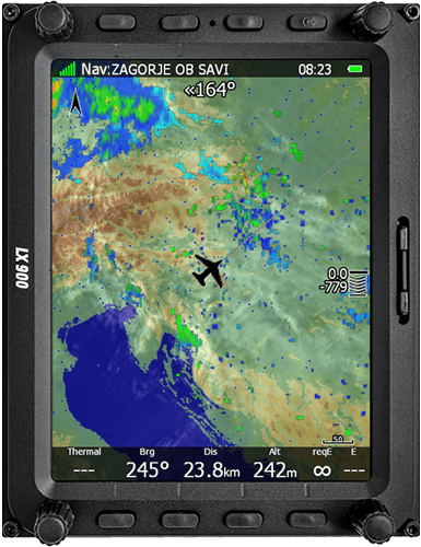
Rain radar.
Don’t be worried while flying a long distance flight – now you can see a real time rain radar picture while in the air.
Many different services with even more on the way.
NOTAMs, flight uploads, GPSAeroData, US Charts, device upgrades and many other features are now just a click away even while flying.
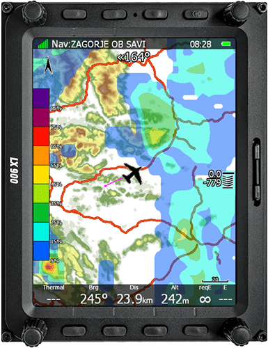
Top Meteo and Skysight weather forecasts.
Its like having a meterologist flying by your side with weather forecast services provided by Top Meteo and Skysigth. More then 20 different weather layers allow you to plan your flight to perfection.
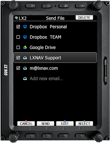
E-mail.
Send flight to your E-mail, eliminating the need to carry SD-card or USB around.
File sharing.
Google drive support makes synchronising waypoints, routes, airspaces and pilot profiles fast and simple.
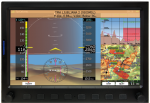
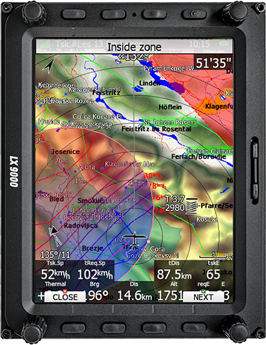
PAN mode. GO-TO.
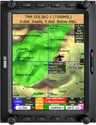
GO-TO function without any waypoints by using a PAN mode. Simple and visual exploring of nearby Airspaces with all details.
Optimized Terrain Schemes.
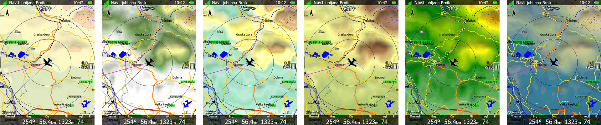
14 Terrain presets available.
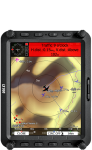
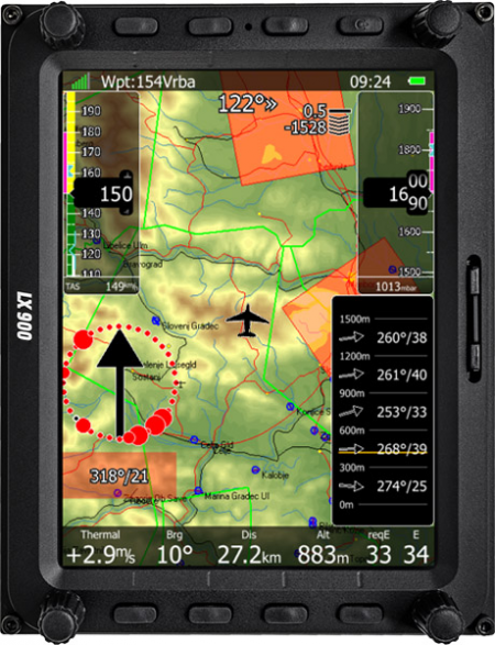
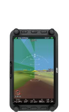
Wind.
Inertial variometer servers a very accurate wind indication during straight flight.
We use 4 different wind methods for the best wind indication.
Wind side profile. Wind arrow.
Wind altitude profile shows wind indication at different altitudes. Wind arrow shows a wind current wind direction. Arrow can be customized by size, position and colour.
Configurations
 |  |  |  |  |
|
|---|---|---|---|---|---|
| LX907 | LX900 | LX905 | LX804 | LX803 | |
| Display vario | 7.0 inch | 5.6 inch | 5.0 inch | 4.0 inch | 2.8 inch |
| Resolution | 800 x 480 px | 640 x 480 px | 800 x 480 px | 480 x 480 px | 480 x 480 px |
| Weight | 650 g | 650 g | 515 g | 460 g | 472 g |
| Size | 113 x 181 x 38 mm | 113 x 145 x 38 mm | 135 x 83 x 61 mm | 82 x 82 x 77 mm | 82 x 82 x 77 mm |
| Power consumption | 480 mA | 480 mA | 480 mA | 380 mA | 380 mA |
Accessories

Remote Stick
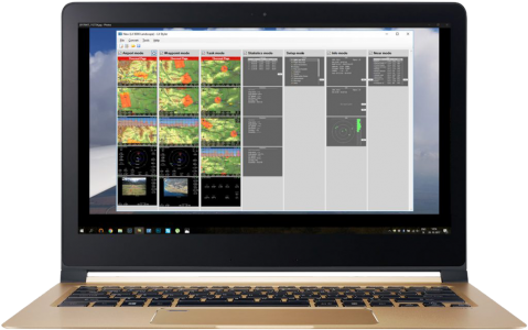
LX Sim
LX Styler